While our low-pressure system moves quickly into the Northeast and New England, a strong cold front stays behind and moves through the Southeast.
Because of the big difference in air masses, parts of Florida, Georgia, and South Carolina are experiencing strong, heavy rain and thunderstorms. The National Weather Service has taken down all of the severe thunderstorm watches, but we can still see some stronger thunderstorms and heavy rain inside the line.
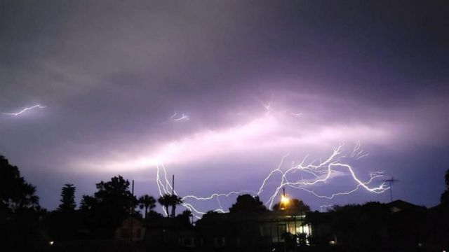
Georgia and South Carolina are about to be hit by our line of heavy rain, wind, and thunder. But we still have a ways to go for most of Florida. Strong winds, frequent lightning, small hail, and heavy rain may happen in Daytona Beach, Orlando, Tampa, and Sarasota.

As this line gets closer, there is a greater chance of rough waves, strong winds, and isolated waterspouts along the coasts of both the east and west coasts of Florida. Special marine warnings may be issued for these areas.
Strong storms will likely start to weaken and break up late this evening as they move closer to Lake Okeechobee and into South Florida.


Leave a Comment