Parts of the country could see “generational flooding” until Saturday due to the possibility of once-in-a-lifetime rainfall and extensive effects, which are being fueled by recurrent rounds of storms that are already in progress. The system that caused Wednesday’s catastrophic tornado outbreak in portions of Arkansas, Missouri, Tennessee, and Kentucky also included the initial wave of storms.
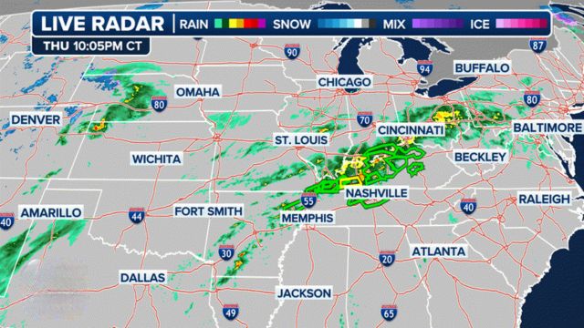
A series of widespread thunderstorms with heavy rain is expected to persist through Sunday as a result of a stalled front that is looming over the central United States.
The National Weather Service in Memphis, Tennessee, issued a warning, stating that the five-day cumulative rainfall values in West Tennessee are between 10 and 15 inches along and north of Interstate 40.

“This is not your average flood risk. Generational flooding with devastating impacts is possible.”
Through Sunday morning, parts of southern Illinois, southwestern Indiana, western Kentucky, and southeastern Missouri are under a “Particularly Dangerous Situation” flood watch.
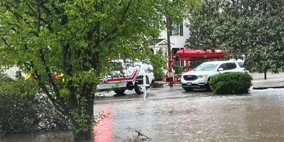
Nashville, Tennessee, was experiencing flooding on Thursday morning. Early in the morning, vehicles were observed stranded in South Nashville floodwaters.
Water rescues were carried out Thursday morning by the Nashville Fire Department. Flooding forced the closure of many routes in the metro area.

There is a 25–100 year recurrence interval for the predicted heavy rainfall in this event.
“In other words, a heavy rainfall event of this magnitude falling within four days is an event that happens once in a generation to once in a lifetime,” the NWS in Little Rock noted.
Many people who live in flood zones, which stretch from Arkansas to the northeast through the Ohio and Tennessee valleys, were urged to get ready by NOAA’s Weather Prediction Center (WPC).
“Anyone surrounding will want to monitor this setup closely as small changes could have heightened impacts given the forecasted setup,” the WPC warned.
The Ohio and Tennessee valleys, where many storm cycles are expected to bring heavy rainfall totals with local amounts as high as a foot by the weekend, are the areas of greatest concern, extending from the Mississippi Valley.

Parts of western Kentucky, the Missouri Bootheel, West Tennessee, and eastern Arkansas have been given the highest danger of flash floods for Friday.
There are worries that storms will repeatedly pass over the same region, a phenomenon known as “training.”
Rainfall totals of several inches have been predicted by computer forecast models, particularly over Arkansas into western Kentucky, where 24-hour totals of 5-8 inches are probable in certain locations.
In addition, there will have been many inches of rain in the preceding days.
“This is an increasingly significant setup approaching with potential for high impacts and life-threatening flash flooding spanning the course of several days,” the WPC stated. “Be sure to prepare if you live in a flood zone anywhere from Arkansas, northeast through the Ohio/Tennessee valleys.”
Heavy rain and strong storms may continue into Friday and Saturday as the unsteady trend continues. Rainfall totals might be close to or more than a foot by the weekend.
Storm total rainfall is currently between 8 and 12 inches across the Quad State, with the largest quantities flanking the Ohio River and the lowest amounts in the far northwest and far southeast, according to the National Weather Service in Paducah, Kentucky, where a state of emergency has been declared.
This Information has been sourced from fox News.


Leave a Comment